Dhankuta District is one of 14 districts in eastern Nepal's Province No. 1. The district has a population of 163,412 people and occupies an area of 891 km2 (344 sq mi). Dhankuta is the administrative centre of the Dhankuta District.
Today in this article, we talk about Dhankuta as a district and as a municipality.
Dhankuta District
Before the merger of Limbuwan and Kirata Kingdoms, Dhankuta was a part of the Kingdom of Nepal.
Dhankuta-Chainpur district was one of the ten districts that existed in Nepal after 1816. Dhankuta-Chainpur was the name given to the region extending east of the Dudhkosi River to the Mechi River.

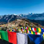
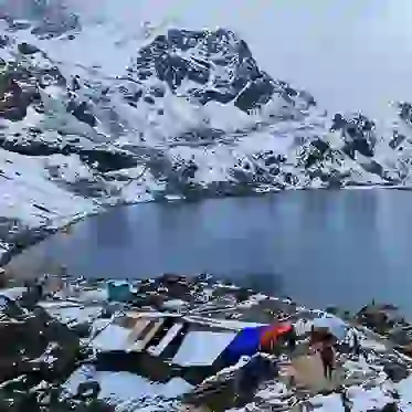
Bhedetar: Gateway to Eastern Hills
Credit:nepaltraveller.com
Nepal was divided into 32 districts from 1885 to 1962, with six districts in the eastern-hill region: East No. 1, East No. 2, East No. 3, East No. 4, Ilam Dhankuta. Dhankuta acted as the administrative base for these districts. Dhankuta was also a significant (by area) district at the time.
The present districts of Sankhuwasabha, Tehrathum, Taplejung, Panchthar, and Dhankuta were combined into one. The former Dhankuta district had a total area of 3,448 square miles (8,930 km2).
In 1962, Nepal was divided into 75 districts, with 16 districts in eastern Nepal forming the Eastern Development Zone, with Dhankuta as its capital.
Geography and Climate of Dhankuta District
Dhankuta is a district in Nepal's eastern hill area situated in the centre of the country. It is located between the latitudes of 26°53' and 27°19' north and the longitudes of 87°8' and 88°33' east.
The district has a total area of 888.7 square kilometres (343.1 square miles) and is situated between 243 meters (9,600 feet) and 629 meters (24,800 feet) above sea level.
Vegetation of the District
The district's vegetation zones range from subtropical Sal forests along the Tamor and Arun rivers to cooler temperate forests on some of the district's high ridges, which act as a watershed between the two catchments. The elevation varies between 300 and 2,500 meters.

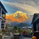
Dhankuta Bazar: Bustling Hilltown Charm
Credit:nepalvisitinfo.com
Maize, barley, and millet are some of the crops cultivated by the majority of the population. Citrus fruits, cauliflower, cabbage, ginger, and, more recently, tea are all-important cash crops.
The climatic zone of Dhankuta is classified into:
- Lower Tropical
- Upper Tropical
- Sub Tropical
- Temperate
How can you reach Dhankuta?
Dhankuta, the headquarter (centre) of Dhankuta District, is connected with NH-08 (Koshi Highway), which connects Dhankuta with NH-01 (East-west Highway) at Itahari. Itahari is 69 km (43 mi) at distance from Dhankuta. The NH-08 also connects Dhankuta to the northern hill and mountainous area.
Dhankuta Municipality
Dhankuta is a hill town and the Koshi Region's administrative centre in Eastern Nepal's Dhankuta District. It has a population of 26,440 people, according to the 2011 Nepal census.
History of Dhankuta
Dhankuta Bazaar (the town) served as the administrative centre for the entire area of north-eastern Nepal until about 1963. The Bada Hakim buildings, the paternal district ruler of the north-eastern area and a man of enormous influence were situated a half-mile above the village.
 The regional jail and army post were also located in the area. Dhankuta was a self-governing region in several respects due to its distance from the lowland Terai and Kathmandu.
Income for non-locally manufactured products (cloth, kerosene, batteries, drugs, etc.) came from a mixture of hill produce purchases (tangerines, tomatoes, etc.), and funds repatriated the hills by Gorkha soldiers serving first in the British and then more often in the Indian armies.
In the fall of 1962, the first five American Peace Corps Volunteers (3 men, two women) arrived in Dhankuta Bazaar to serve as teachers in the two high schools. Three male PCVs arrived in October 1963 to assist in the creation of the new Panchayat Development program.
Since 1963, Nepal has been divided into 75 Panchayat Districts, with the conventional Dhankuta administrative area divided into roughly six of them.
The Bada Hakim's authority was transferred to the Panchayat Development Officer, appointed by the central government, and each district's elected Panchayat Chief.
Dhankuta Bazaar prided itself on being a cultural trailblazer, a comparatively progressive society with its own "intellectual" elite during the pre-panchayat era.
Dhankuta Bazaar had the only high school south of the Kathmandu Valley in Nepal as early as the 1930s.
The difference between Dhankuta Bazaar and the nearby rural villages was stark then and now. The town is a commercial hub with a largely Newar population.
Current Status of Dhankuta
On the North-South Koshi Highway, Dhankuta Bazaar is now the administrative headquarters for the Eastern Development Region and several offices for NGOs and aid agencies operating in the region. Hile's large bazaar, farther up the road, is an important trade hub and main road junction, serving the Arun valley's remote hinterlands and Bhojpur.
 Villagers walk for days from nearby districts to trade in the Hile and Dhankuta bazaars, even though road development in the neighbourhood can reduce their value.
Dhankuta was named "Nepal's cleanest city" by the Kathmandu Post.
Popular Tourist Areas in Dhankuta
- Pakhribas
- Hile
- Namaste Jharna (Waterfall)
- Chintang Devi Temple
- Bhedetar