Baglung District is one of Nepal's seventy-seven districts and is located in Gandaki Province. The district, which has Baglung as its district headquarters, has a population of 268,613 people and occupies an area of 1,784 km2 (689 sq mi).
Today we talk about different aspects of Baglung.
Introduction to Baglung District
Baglung is surrounded by the districts of Myagdi, Parbat, Pyuthan, Rukum, Rolpa, and Gulmi. There are 59 Village Development Committees and a Municipality in the region. Baglung is better known as the "District of Suspension Bridges" because of its many suspension bridges. It is a hilly district with the majority of the people living along the rivers' banks.

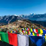
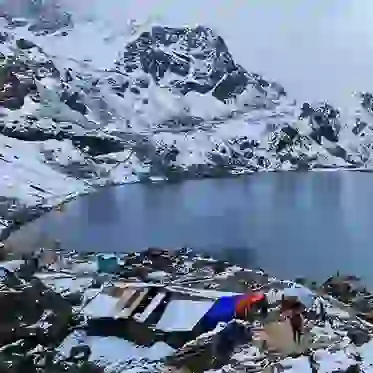
Baglung Panchakot: Historic Majesty Captured
Credit: Imagepasal.com
The fertile soil on both sides of the rivers were used for agriculture. Baglung Municipality, the district's headquarters, is situated on a hill overlooking the sacred Kali Gandaki. Baglung, like Nepal, is diverse in terms of religion, history, race, altitude, and temperature.
Herbal medicinal plants abound in Baglung. Baglung's principal crops are rice, corn, millet, wheat, and potato. In the past, small-scale mining, mainly for iron and copper, was a significant operation in Baglung. However, owing to the economics of running small mines, the majority of them have since closed.
In modern times, slate mining is the most common form of mining. Baglung slate is thought to be outstanding for roofing.
Baglung's primary trade centres are Baglung Municipality, Hatiya- Galkot, and Burtibang. Roads bind Kusma, Galt, and Burtibang to Baglung Bazaar, the district headquarters. Nepal Electricity Authority and a number of small local hydropower plants serve Baglung.
Telephone service has recently been made available in nearly all Baglung villages. Baglung is one of Nepal's most politically aware districts, and it plays an integral part in the country's politics.
How Can You Reach Baglung?
Baglung is now at the crossroads of Nepal's main north-south and east-west highway networks, thanks to the completion of many road projects. The Kaligandaki corridor highway, which connects Tibet to the north via Mustang and border towns to the south, has begun construction.
Similarly, the city is bisected by the mid-hill highway that divides Nepal's eastern and western halves. Baglung is connected to Kushmi Sera in the south by the Hari Bahadur Khadka memorial road, which also provides access to Balewa airport.
Baglung is linked to Myagdi's Beni Bazar to the north and Parbat's Kusma Bazar to the south, which are 13 km (8.1 mi) and 12 km (7.5 mi) apart, respectively. The Pokhara Baglung highway links the town to Pokhara, which is 72 kilometres (45 miles) east.
Baglung Bazar is the starting point for another significant road network linking Gulmi district in the south, which passes through Sigana, Gaja, and Bareng.
A road network connecting Baglung Bazar and Bihu, which passes through settlements higher in the northern flanks of the Kathe Khola valley, was recently completed under the initiative of the late member of parliament, Hari Bahadur Khadka. Aside from major highways, the town is connected to the surrounding rural areas by a network of small seasonal dirt roads.
There are several pedestrian suspension bridges in the city. Baglung is known as the "country of suspension bridges" because of the abundance of them. Pharse, Nirahe, Nayapul, and Kaiya are all important Kaligandaki river crossings.

Baglung Bridge: Crossing Boundaries Gracefully
Credit:Nepaltraveller.com
The Kaligandaki bridge connecting Kaiya and Kushma is noteworthy for having Nepal's most prominent and longest span. The Kaligandaki River is crossed by a mechanical cable car that connects Narayansthan and Kushma. Within the city limits, several other suspension bridges connect numerous rivers and creeks.
Balewa's Baglung airport is 12 kilometres south of the town, across the valley from Kusma. This airport has been decommissioned after the Pokhara-Baglung highway was completed. Water transportation is almost non-existent.
The nearby Kali Gandaki river, on the other hand, provides some of Nepal's best white-water rafting and draws a sizable number of thrill-seekers each year.
Climate of Baglung District
In summer, the lowest temperature at Dhorpatan is around 15 degrees Celsius, while the highest temperature at Baglung's lowest elevation is about 37.5 degrees Celsius. Baglung is divided into five climatic zones. They are:
- Upper Tropical
- Subtropical
- Temperate
- Subalpine
- Alpine
Effect of 2015's Earthquake on Baglung District
An earthquake in Nepal in April 2015 had a minor impact on the district. Many historic structures were damaged, and a few even collapsed. Many of the designs have since been restored by the owners.
Places to Visit in Baglung District
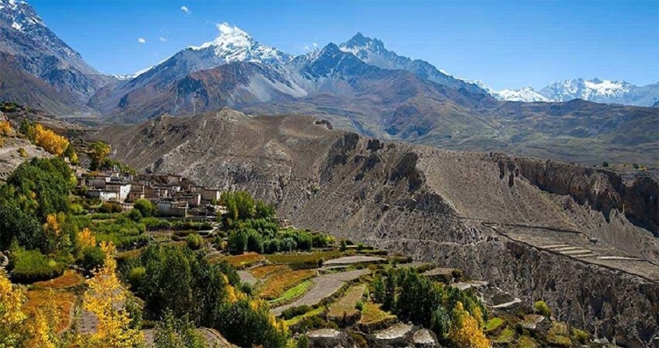
From Baglung, you can see the Himalayas. The Dhaulagiri and Annapurna ranges can be seen from Bhakunde and Panchakot. The region is rich in terraced lands, waterfalls, deep gorges, woodland, and caves. Baglung is a popular destination for thrill-seekers due to the terrain's suitability for trekking, biking, and rafting.
In the past, Baglung acted as a starting point for trekkers heading to Mustang, Dolpa, and Mt. Dhaulagiri. Baglung now serves mainly as a staging point for travellers to these areas as a result of the extension of road networks. The district includes the Dhorpatan Hunting Reserve, Nepal's only hunting reserve and a sanctuary for blue sheep and snow leopard.

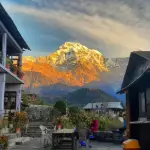
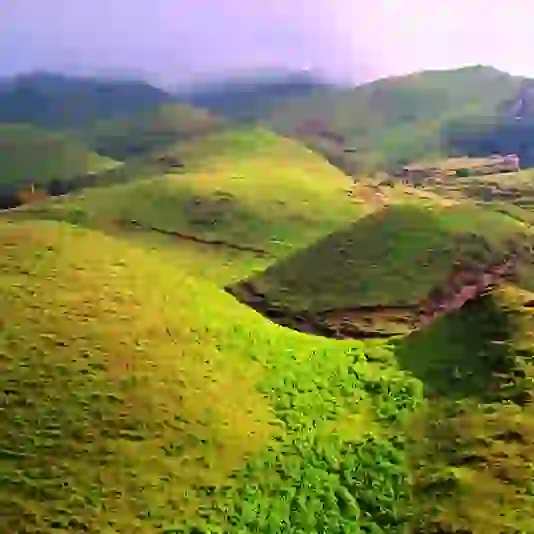
Baglung Valley: Nature's Tranquil Elegance
Credit:Nepaltrekking.com
Baglung has resurfaced on tourist maps thanks to a recent increase in interest in the hunting reserve, Putha Himalaya range, round Dhaulagiri trekking, and "Guerrilla trek."
There are many tall suspension bridges in the city. Nepal's most elevated, one of them connects Balewa within the city's southern limits with Kushma across the Kaligandaki River. Tityang is connected to the city centre by a second, shorter bridge that crosses the Kathekhola canal.
Pilgrimage places abound in and near Baglung's temples. The Kaliaka Bhagawati Temple, the most famous of all religious sites in Baglung, attracts thousands of pilgrims each year. During the Chaitra Dashain festival, an annual fair, one of Nepal's most significant, is held.

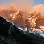
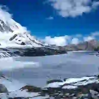
Panchakot: Historic Fortress Beauty
Credit:myrepublica.com
Panchakot is being established as a pilgrimage and religious education centre under the patronage of Shree Muktinath Baba Kamalnayanacharya. On Tuesdays, devotees flock to Balewa Bhairavsthan, an ancient temple situated atop a mountain ridge.
Temple of Balaji Other pilgrimage sites include Kundule, Niraheghat, Gaurighat, Malika, Khaniyaghat, and Maikuti.