Dharan is a Metropolitan city in eastern Nepal, located in the Sunsari District. It is situated on the northern slopes of the Mahabharat Range, with its southern point touching the Terai area at the height of 1148 feet (349m).
It serves as a trading centre between the Terai area's mountainous terrain and the lowlands. It was previously home to the Brigade of Gurkhas' recruitment centre, which opened in 1953. Since 1993, the site has been home to the B.P. Koirala Institute of Health Sciences, which has been located on the campus.
Dharan Sub-metropolitan City had a Golden Jubilee celebration from January 28 to January 31, 2011, to commemorate the municipality's 50th anniversary. It is Eastern Nepal's second-largest city. It is also known as Nepal's soccer/footballer manufacturing factory.
History of the City of Dharan
Ancient History
The Ten Kings of Limbus gathered to formally announce "Yakthung Laaje" to the ten kingdoms between the Arun River and the Teesta River.
The ten kings, their kingdoms, and their forts are as follows:
- King of Tambar, Samlupi Samba Hang, and his capital, Tambar Yiok.
- Sisiyen Shering Hang, King of the Mewa and Maiwa kingdoms, and Meringden Yiok, his capital.
- King of Athraya, Thoktokso Angbo Hang, and his capital, Pomajong.
- Thindolung Khokya Hang, King of Yangwarok, and Hastapojong Yiok, his capital.
- King of Panthar, Yengaso Papo Hang, with capitals in Yashok and Pheden (Phe meaning "plain", den meaning "place").
- Shengsengum Phedap Hang, King of Phedap, with Poklabung as his capital.
- King of Ilam, Mung Tai Chi Emay Hang, with his capital at Phakphok.
- King of Bodhey (Choubise), Soiyak Ladho Hang Chemjong, and his capital at Shanguri Yiok.
- Tappeso Perung Hang, King of Thala, and Thala Yiok, his capital.
- King of Chethar, Taklung Khewa Hang, and his capital at Chamling Chimling Yiok.
Rise of King Mawrong
After a brief period, King Mawrong Hang rose to power and conquered the Terai kingdoms of Chethar, Bodhey, Panthar, and Ilam (present-day Jhapa, Morang Sunsari and Dhankuta). He ascended to power and called his kingdom Morang after himself. He defeated all ten Limbu Kings of Limbuwan and ascended to the position of overlord. He died without a male heir, and King Uba Hang succeeded him as Limbuwan's ultimate monarch in 849 AD.
In Limbuwan, he instituted several religious and social changes. Mabo Hang, Uba Hang's deserving son, succeeded in 865 AD and reigned until 880 AD. Uba Hang continued the modifications that his father had begun. Muda Hang, Uba Hang's son, followed him. Because Muda Hang was a weak king, the local chiefs started to control their territories.
Muda Hang's son, Wedo Hang, succeeded him; at this time, Limbuwan had devolved into anarchy, with each principality ruling autonomously and fighting one other. Wedo hang was assassinated, and his son Chemjonghang took his place.
Rise of King Sirijonga
As King Chemjong hang's reign dwindled during this upheaval, Yangwarok kingdom's King Sirijonga rose to prominence. He defeated all the separate rulers and became Limbuwan's new ultimate monarch. He constructed two prominent forts at Phedap (now Terhathum district) and Chainpur (present-day Sankhuwasabha district).
The structure's ruins can still be seen today. One of his legacies was to unite the Limbus under a standard writing system based on the Kirat script. He also instituted feudal reform in Limbuwan and reorganized the province into new districts and limits.
After the formation of the Namgyal dynasty in Sikkim and the signing of the Lho-Mehn-Tsong Tsum, a mutual treaty between the Lepcha, Bhutia, and Limbu people of Sikkim, Limbuwan lost the area between the Kanchenjunga range (now the eastern border of Nepal) and the Teesta River to the Bhutia Kings of Sikkim.
Limbuwan now encompasses the entire region stretching from the Arun River and Koshi River west to the Kanchenjunga Mountains and Mechi River in the east.
The successors of King Sirijonga were weak in the early 15th century, and Limbuwan descended into turmoil and anarchy once more. King Sangla Ing controlled the Lowland Limbuwan Kingdom of Morang at the time.
Sangla Ing declared independence and became Morang's first self-governing king in a century. Pungla Ing, his son, converted to Hinduism and changed his name to Aamar Raya Ing. Aap Narayan Raya Ing, Kirti Narayan Raya Ing, Ding Narayan Raya Ing, Jarai Narayan Raya Ing, and Bijay Narayan Raya Ing were his descendants, all of whom had Hindu names.
Amid Varatappa and Shangori fort, King Bijay Narayan Raya Sanlga Ing constructed a new town and named it Bijaypur. He didn't have any problems and died without a successor.
Bijaypur town was formed in 1584 AD and is now located in the Sunsari District, near Dharan. Until the Gorkha Limbuwan War, which started in 1774 AD, Bijaypur town was the capital of the Morang Kingdom and Limbuwan area.
It was one of the most powerful and influential kingdoms of all the Limbuwan kingdoms, and it was able to establish hegemony over all other Limbu kings. However, Morang was taken by Kirant King Lo hung Sen of the Sen dynasty in 1609 AD, and he controlled it for seven generations.
Murray Hang, King of Phedap, was appointed as Morong's chief minister. He remained at Bijaypur, and the King of Morang appointed him to a hereditary position. Murray Hang was renamed Bidya Chandra Raya and given a Hindu name.
Until Buddhi Karna Raya Khebang, his descendants were Chief Ministers of Morang. In 1769 AD, Buddhi Karna Raya Khebang ascended to the throne of Bijaypur Palace, succeeding the last Sen King of Morang, Kama Datta Sen.
Modern Times
Dharan was founded as a modest trade post. Dharan's population has grown and diversified over the last several decades, including people of many ethnicities like Limbu, Brahmins, Chhetris, Rai, Gurung, Newar, Sunuwar, Yakha and others.
Prime Minister Chandra Shamsher set the basis for modern Dharan in 1902. He founded Chandranagar, a tiny hamlet at the foot of the Bijayapur hilltop (now Purano Bajar). The goal was to provide timber to the East India Company, expand its North-Eastern region, and build railway tracks in the 1890s.
Subba Ratna Prasad was the first government official to be appointed in this tiny hamlet. Over time, the community increased gradually in size. After Prime Minister Juddha Shamsher, this burgeoning town was named Juddha Nagar (now Naya Bazaar). In 1960, it was designated as a municipal town.
In 1953, the British Gurkha Recruit Center was built, which accelerated the influx of personnel and the town's growth. Recruits from all around Nepal came to join the British Gurkhas, transforming Dharan dramatically.
With recruits bringing their families and others seeking job and business possibilities, there was a rise in population. As a result, Dharan has grown into one of Nepal's most populous cities. It truly is a meeting point of many ethnic groups, languages, dialects, and faiths.
Dharan was designated as the zonal headquarters of the Kosi Zone when Nepal was split into 14 administrative zones and 75 districts in 1962.
The town was formerly split into eleven wards, but in 1980, Banjjhogara Gaon Panchayat in the east and Ghopa Gaon Panchayat in the west were amalgamated with Dharan Town Panchayat. The wards were reformed as a result of the expansion. In 2014, Dharan was split into twenty-seven wards.
Where Does Dharan Get Its Name From?
Dharan is a Nepali name that translates to "wood sawing location." A typical Dharan is dug out of a rectangular area that is roughly 5 to 6 feet deep. This hole is vast and deep enough for an adult to move about without difficulty.
To cover part of the hole, a platform is built. A piece of lumber is placed on the platform, and a two-person team, one standing on the platform and the other working in the dugout, begins sawing the wood with a massive saw blade. This is a time-consuming and risky technique.
Culture Of The People Of Dharan
Dharan is a cultural melting pot that represents a blend of Nepal's different cultures. Many people from the surrounding districts dwell in Dharan, including Sankhuwasabha, Ilam, Tehrathum, Panchthar, Dhankuta, Taplegung, Bhojpur, Khotang, and others.
 Throughout the year, many ethnic groups have their unique cultural celebrations. The Limbus' Dhan naach (Dance), the Newars' Lakhe naach (Dance), Chyabrung naach (Dance), and Chasok Tangnam, and Gai Jatra, the Rai's Sakela, Gurungs' Rodighar, Tamangs' Selo, Brahmin and Chhetris' Baalan and Sangini, and San In Dharan, there is also a Sakela tournament every year.
It begins on Baisakh Sukla Purnima (the full moon of the first day of Baisakh month) and lasts for 15 days. A Hindu deity Hanuman's temple named Panchmuki Balaji Dharan Dham is Dharan's most important dedicated temple. Because of its magnificence and truthfulness, many stories are related to the temple.
People travel from all across India, including West Bengal, Sikkim, Rajasthan, and Nepal, to seek Lord Hanumana's blessings. Every six months on the day of Purnima, a mela is conducted in this temple, as Lord Hanuman was born on this day.
Places to Visit in Dharan
Dharan is a popular tourist attraction in and of itself. The primary languages of communication are Nepali and English. People who know English should have little trouble understanding many of the signs and maps in Nepal.
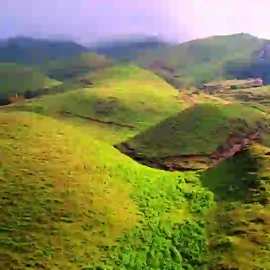
Dhankuta, Bhojpur, Phidim, and Terathum are among the eastern highland districts beyond Bhedetar. Kumbhakarna Himal, Kanchenjunga, Arun Valley, Makalu Barun National Park, Gupha Lake, Tinjure-Milke (Rhododendron Protection Area), Hyatrung Fall, and Sabha Pokhari are just a few of the distant tourist sites accessible from Dharan. They are reasonably far away, necessitating multi-day excursions.
The city of Biratnagar and its surrounding settlements are located south of Dharan and are all within an hour's drive. Bhanu Chowk is also known as Dharan's beating heart. The megacity Itahari is well-known among Dharan's residents.
Dharan boasts several places of worship with such a varied population, including temples, churches, and a mosque. Bijaypur Hill is significant because it has numerous vital temples, including Dantakali temple, Budha Subba Temple, Pindeshwar temple, and Panch Kanya. As well as being religious, these temples are historically and archaeologically significant. Rituals, festivals, and festivities are held at these temples.
The Tamur River, which runs from Mulghat in Dhankuta district to Chataradham, has been a popular white water rafting destination due to its close vicinity.
Tourism Activities in Dharan
The following are some prospective tourism prospects:
- For the dare-devils, there's paragliding from the nearby hills and Bhedetar.
- Panchakanya, a Natural Park, is being turned into a mini-zoo.
- Chaarkose forest flora and wildlife protection and development.
- Dharan-Bishnupaduka-Baraha Kshetra cable car.
- Better promotion of the Babadham fair.
- Dharan is constructing an airport.
How Can You Reach Dharan?
Dharan is connected to Dhankuta via the Koshi Highway, one of the main highways. Dharan is connected to Biratnagar and other nearby towns via regular bus services and rented automobiles. The nearest airport is Biratnagar Airport (40 km). Biratnagar is around 40 kilometres from Dharan. Travelling by car from Biratnagar to Dharan takes approximately an hour and costs roughly 70 rupees.
Tourist buses depart Kathmandu, Nepal's capital, every day at 3:30 p.m. from the Swayambhu bus station close to the Swayambhunath Temple, arriving about 7 a.m. the following day. The cost of a ticket is around 1,100 rupees.
Taxis, local buses, microbuses, auto-rickshaws (or tuk-tuks), and rickshaws make up the regional transportation system. The most cost-effective method of transportation is sharing a trip with other passengers on microbuses and auto-rickshaws.